


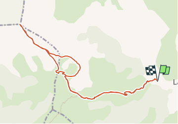

8,5 km | 15,9 km-effort

Gebruiker GUIDE


Gratisgps-wandelapplicatie
 SityTrail
IGN / Geografische instituten
SityTrail World
De wereld gaat voor u open
Tocht Stappen van 11,5 km beschikbaar op Provence-Alpes-Côte d'Azur, Hautes-Alpes, Le Dévoluy. Deze tocht wordt voorgesteld door Marco05.
Sommet du Dévoluy assez difficile vu sa pente finale.
Le départ se situe au dessous de La Cluse.
Passage au col de Plate Contier et au Pas de l'agneau.
Attention à cet endroit c'est très aérien. Ne pas s'approcher du bord.
Au retour, on peut passer par la tête des Ormants, mais ce n'est pas obligatoire, car ça rajoute de la difficulté physique.


Stappen

Stappen

Stappen

Stappen

Stappen

Stappen

Stappen

Stappen
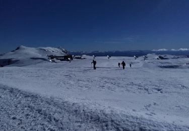
Ski randonnée